CITIES
- Alphabetical Link-list For Each City's Main Website (Wikipedia)
- For Information About CCC Cities, In General (Google Search)
- Link-list For Each City's Main Website (thru CCC's Main Website)
- Physical Geography of the County (Wikipedia)
- Zip Code Map for Contra Costa County
CLIMATE & WEATHER
HABITATS
- Contra Costa County Climate Page (Golden Gate Weather Service Site)
- Contra Costa County Weather Precipitation Daily (Natl Weather Svc)
HABITATS
HEALTH
HISTORY
LAND
MAPS
- MAP 1 depicts points of interest in the jurisdiction.
- MAP 2 depicts points of interest and low-moderate income areas.
- MAP 3 depicts points of interest, low-moderate income areas, and minority concentration levels.
- MAP 4 depicts points of interest, low-moderate income areas, and unemployment levels.
- MAP 5 depicts low-moderate income areas, unemployment levels, and proposed HUD funded projects; in addition, a table provides information about the project(s).
- MAP 6 depicts points of interest, low-moderate income areas, unemployment levels, and proposed HUD funded project(s) from a street level vantage point.
- Contra Costa County - Boat Ramps: Locator Map: Clickable
REGIONAL
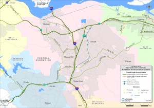
- Contra Costa County Regional Map - TRANSPAC
- Sacramento - Delta - Recreation - Web Site (Providing a wealth of information concerning California Delta Boating, Delta Marinas, Delta Yacht Clubs, Delta Fishing, Delta Water sports and even Delta camping.)
SFBA~ EAST BAY~ COUNTY~ CONTRA COSTA: CITIES: Map:


Thank you kind sir for the map. It was really helpful in my econ class.
ReplyDelete